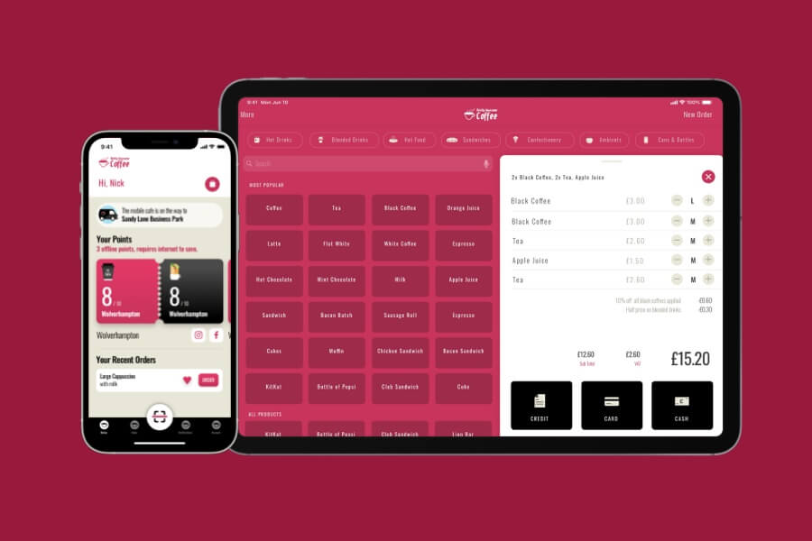
Frequently Asked Questions
How do you build a GPS enabled app?
We begin by integrating device GPS modules with real?time tracking systems and map interfaces on both Android and iOS platforms. We employ native SDKs and third?party services for accurate location capture and route display, and we test rigorously to ensure performance, accuracy and battery efficiency.
What APIs do you use for location services?
We leverage Google Maps, Mapbox, HERE and OpenStreetMap APIs. The choice is based on licensing, feature requirements and performance criteria. Where signal or map data is unavailable, we implement fallback strategies to maintain user experience.
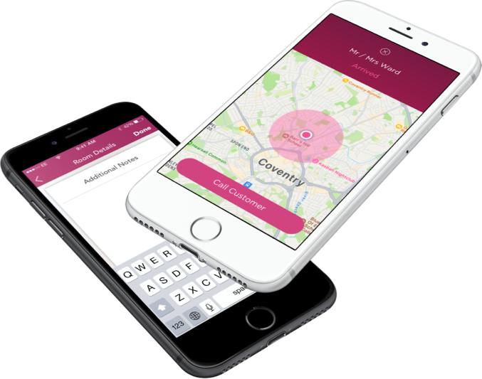
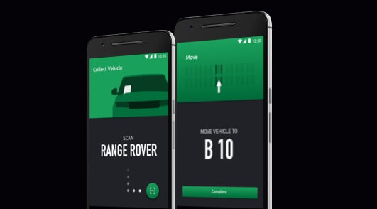
How do you implement geofencing and alerts?
We define geographic boundaries programmatically and monitor entry and exit events to generate notifications in?app or via push messaging. Use cases include automatic check?ins, delivery confirmations and restricted?area alerts.
How accurate is mobile GPS tracking?
Standard GPS tracking accuracy ranges between 5 and 10 metres, depending on device and environment. To improve performance in urban or low?signal areas, we apply smoothing algorithms, use assisted GNSS and cache offline data. We continually test during development to ensure accuracy in real?world conditions.
How do you ensure user location data is secure?
We enforce encryption for all transmissions and use token?based access. We manage permissions using OS?level APIs on Android and iOS, ensuring users have full control. Our processes comply with GDPR and use data minimisation principles to limit excess collection.
What are best practices for location tracking in mobile apps?
We recommend adaptive polling rates, UI prompts for permissions, minimising battery usage and enabling privacy filters. Our approach includes thorough testing across various devices to ensure reliable and efficient location tracking.
Book a Free Discovery Call